
February 11, 2025:
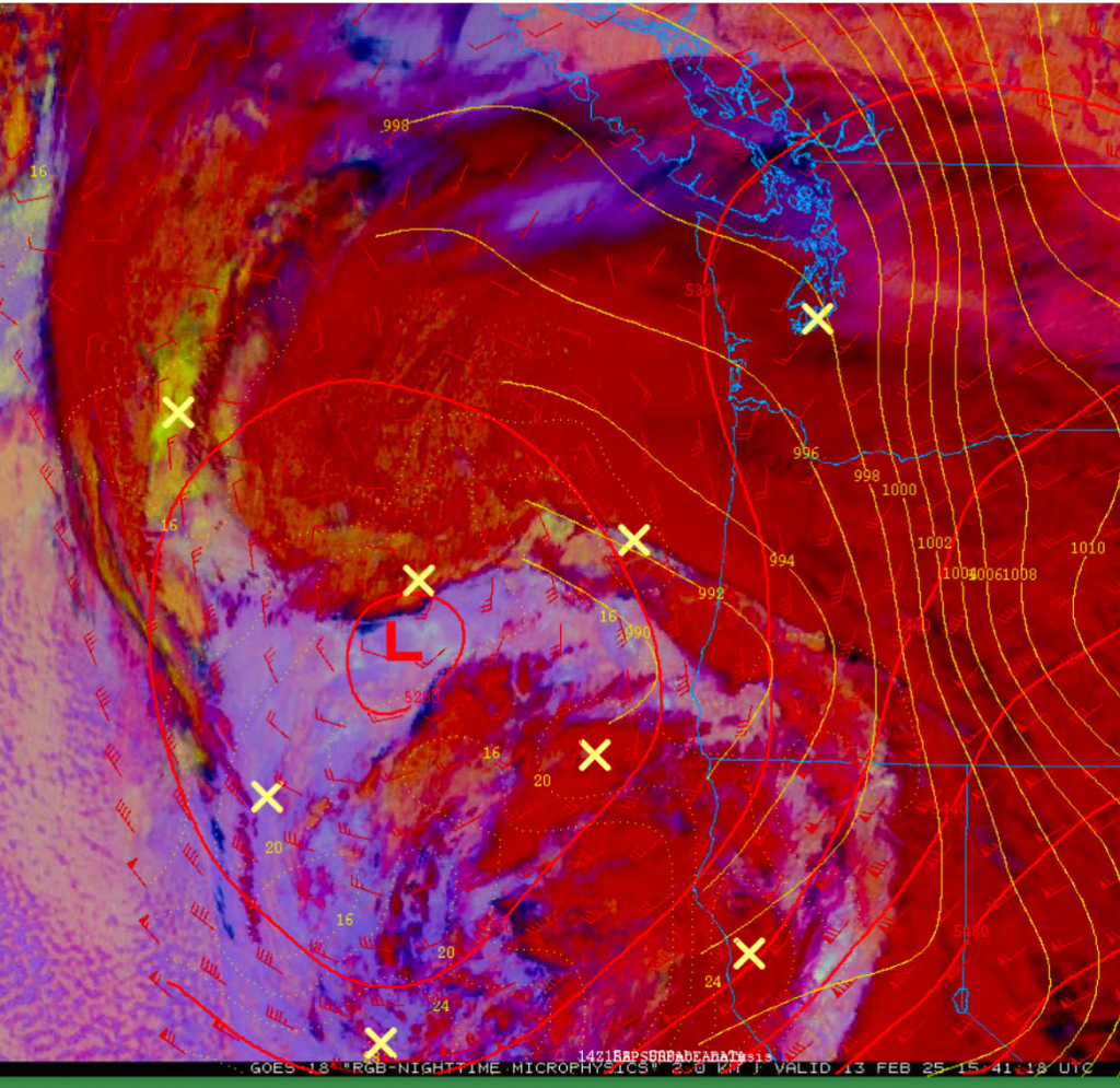
As of February 11, 2025, it had become increasingly apparent that the Portland Metropolitan Area was going to experience significant winter weather from February 13, 2025, through February 14, 2025. This forecast was driven by the positioning of an upper-level low and the influx of cold modified Arctic air flowing into the region from the Columbia River Gorge. These conditions resulted in widespread occurrences of snow, freezing rain, and sleet throughout the area, including the Willamette Valley.
One of the primary challenges lay in accurately forecasting the distribution of snow versus freezing rain and sleet across the region. Additionally, precise timing of the moisture’s arrival was crucial, as it had substantial impacts on both the morning and evening commutes on February 13, 2025.
The following is a post I provided on Facebook on February 11, 2025 at 6:11 PM:
“Confidence is increasing that we will see snow, freezing rain, and sleet this Thursday and Friday.
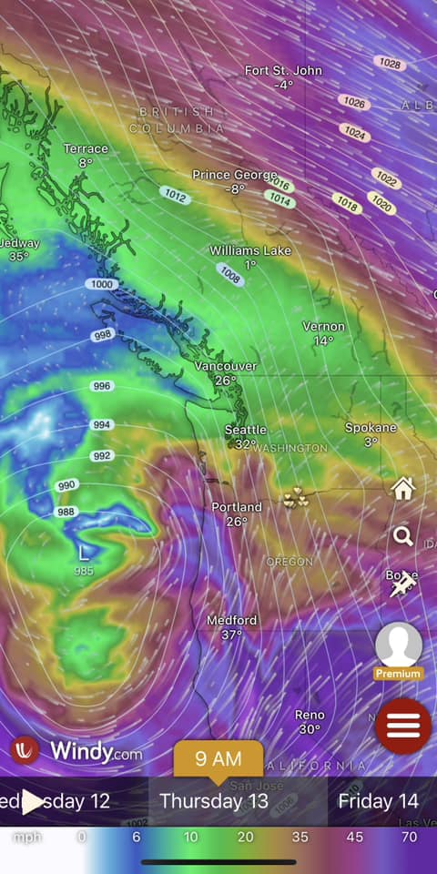
A modified Arctic air mass has settled over the Portland metro area and looks to linger through Friday morning. Wednesday should remain dry, but an upper low moving toward the region on Thursday will bring precipitation. With temperatures ranging from the upper 20s to low 30s from Thursday morning through Friday morning, much of this precipitation will fall as snow, freezing rain, or sleet.
Why not just snow?
While surface temperatures will be cold enough to support snow, a layer of warmer, above-freezing air will be present higher up in the atmosphere. (I know, weird, right?) In areas where the cold air near the surface is shallow, precipitation will melt as it falls through the warmer layer, then refreeze before reaching the ground—resulting in freezing rain or sleet instead of snow.
Timing and Impacts
The big question: How much snow or ice will we see, and when?
Precipitation will push in from the south on Thursday morning, though models disagree slightly on timing—some bring it in very early morning, while others hold off until mid-to-late morning. Most areas will start with snow, but depending on location and timing, a transition to freezing rain or sleet is likely by late morning or early afternoon.
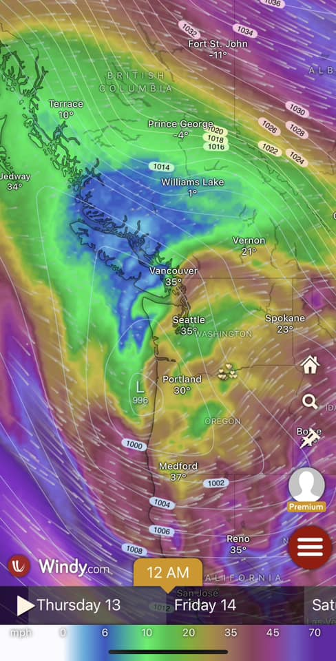
We may see a break in precipitation during the afternoon, followed by another round of mixed frozen precipitation Thursday night. Early Friday morning looks colder, favoring more snow before another transition back to freezing rain and sleet near sunrise. Temperatures should warm above freezing during the day Friday, but significant snowfall could slow the melting process. By the weekend, a more substantial warm-up will help melt any remaining snow and ice.
Snow & Ice Accumulations
Totals will vary by location, but overall, expect 1/2” to 3” of snow, with some areas possibly falling outside this range. Ice accumulation is still uncertain but could lead to hazardous conditions.
Travel Impacts
Expect significant travel impacts Thursday evening and Friday morning, with some potential impacts Thursday morning as well. Plan accordingly and stay updated on the latest forecasts.“
February 12, 2025:
On February 12, 2025, we observed that the arrival of precipitation was likely to occur earlier than projected by the models. This increased confidence that we could see potential impacts for the morning commute on February 13, 2025. By this time the National Weather Service did issue a Winter Storm Warning for the Portland Metropolitain Area.
The following is a post I provided on Facebook on February 12, 2025 at 4:03 PM (No graphics included in the post):
Afternoon Portland Metro Winter Weather Update ![]()
![]()
![]()
We’re on track for widespread winter weather across the Portland area tomorrow and Friday, with a mix of snow, sleet, and freezing rain.
Timing & Expected Impacts
The latest model guidance shows precipitation arriving earlier than initially expected. Clouds are already pushing in from the southwest, marking the leading edge of an approaching upper low. As this system moves closer, easterly winds will strengthen overnight.
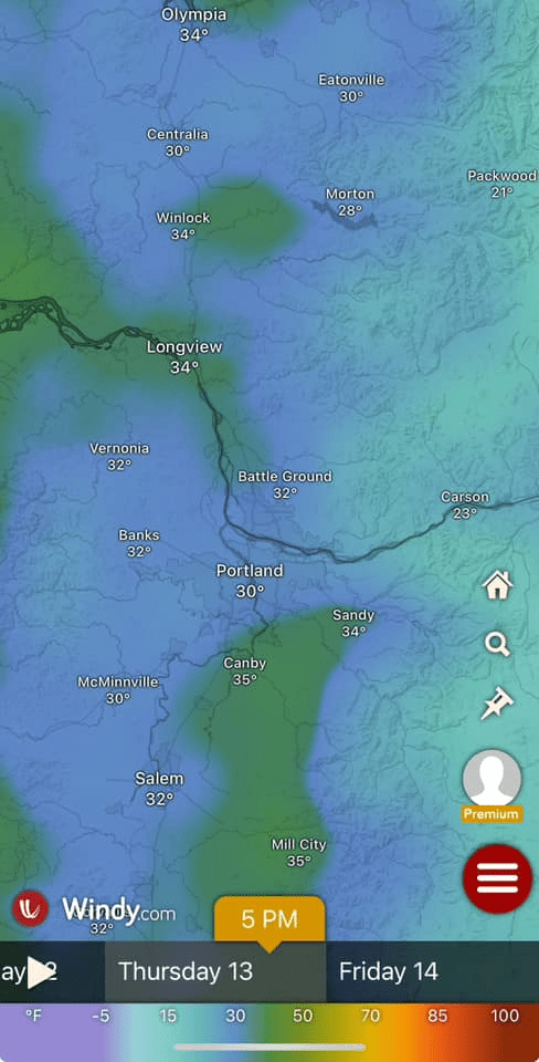
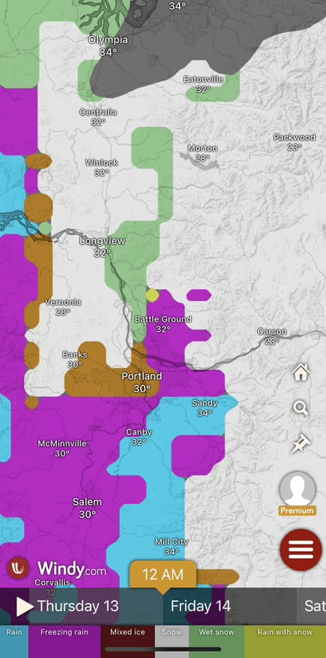
• Thursday Morning (5 AM – 8 AM): Precipitation begins, starting as snow across the region.
• By Noon: Most areas should see some accumulation, ranging from a trace to 2 inches, with localized higher amounts. The west side is likely to see more snow than the east side due to drier air limiting totals. Some freezing rain is possible, especially south of the metro area.
• Thursday Afternoon: A lull in precipitation is expected before another round arrives later in the afternoon or evening.
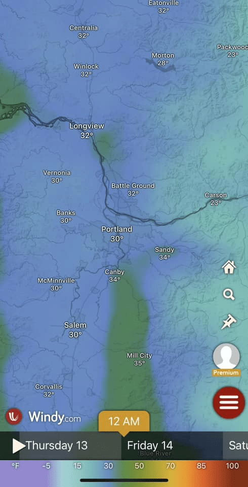
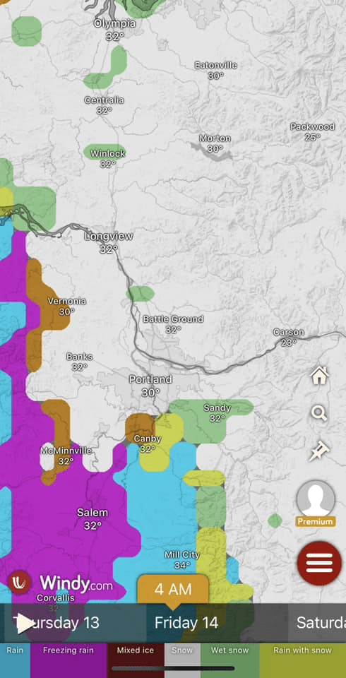
• Thursday Evening – Overnight: Precipitation initially falls as freezing rain/sleet, with 0.1 to 0.2 inches of ice accumulation possible. Ice amounts may be higher south of Portland. Overnight, precipitation could transition back to snow, adding another 1 to 2.5 inches in most areas.
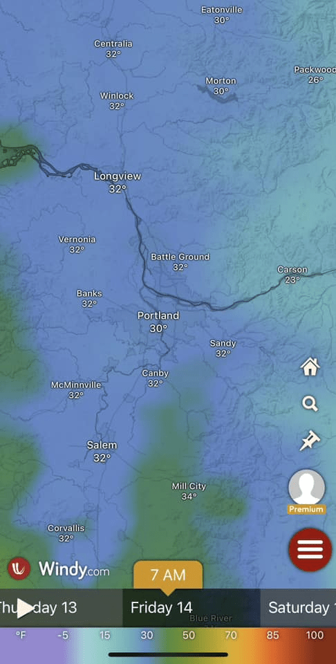
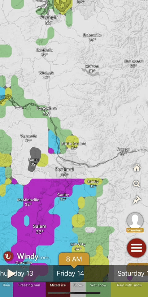
• Friday: Snow tapers off by the afternoon, with some melting possible during the day. However, refreezing is likely overnight.
• Weekend Warm-Up: A warmer airmass and rain will move in, gradually scouring out the cold air and allowing for a full thaw.
Commute & School Impacts
Expect both the morning and evening commutes to be impacted on Thursday and Friday, with the worst conditions likely Thursday night into Friday morning. School closures are probable—I’d advise districts to call a snow day for the entire metro area, but that’s out of my hands!
Power Outages
There’s a high likelihood of power outages, especially in areas that receive more freezing rain, primarily south of Portland.
Who Gets the Most Snow?
The west side of the metro area is favored for higher snowfall totals.
Winter Storm Warning
The National Weather Service has issued a Winter Storm Warning for the area:
Winter Storm Warning Link: https://www.weather.gov/pqr/
Stay safe, everyone! I’ll be posting plenty of nerdy snow pics tomorrow—along with appearances from Bernhard, my snow-loving pup. Looking forward to seeing yours too!
February 13, 2025
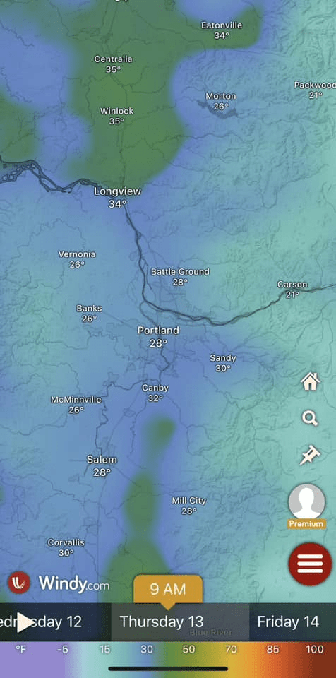
Reports of light snow showers began appearing on social media around 7:30 A.M. In Forest Grove, OR (westside of Portland, OR), very light snow showers started around 7:41 A.M.
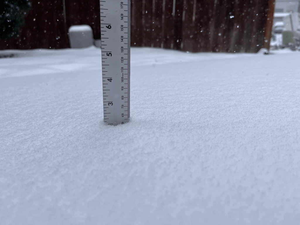
Snow showers increased in coverage throughout the morning across the Portland Metropolitan Area, moving from south to north. By 11:45 A.M., Forest Grove, OR had accumulated slightly over 2 inches of snow, with light snow continuing to fall.
Snow showers continued through midday, ending at about 1:00PM PST in Forest Grove.
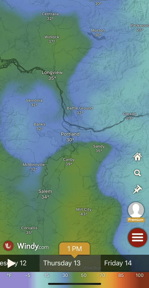
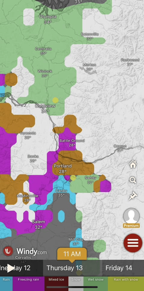
During the afternoon, there was a widespread break in snow showers. However, by late afternoon, a second round of precipitation advanced from the south. With warming air aloft and easterly winds maintaining a cold pool at the surface, it became evident that the incoming precipitation would manifest as sleet and freezing rain.
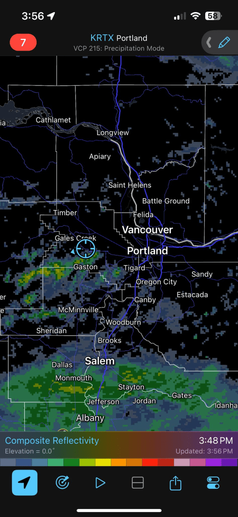
By about 5:45 P.M. PST, numerous reports of freezing rain and/or sleet began coming in from the southern metropolitan area. Shortly after 6:00 P.M. PST, widespread reports of freezing rain and sleet were being received across the entire area.
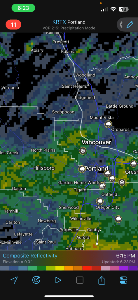
Throughout much of the night, sleet and freezing rain persisted, eventually transitioning to snow around midnight.
February 14, 2025
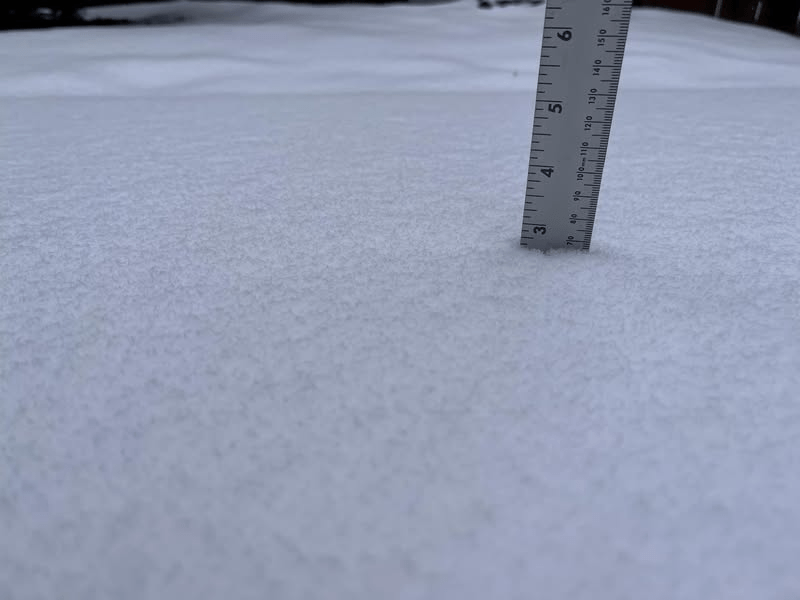
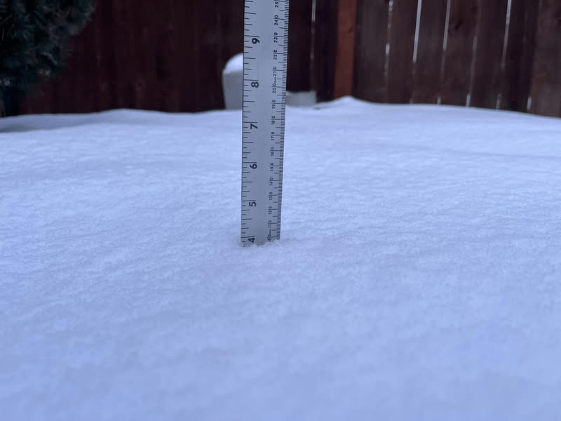
Snow continued overnight across the region, with many locations reporting between 1/2″ to 2″ of additional snow and ice accumulation from Thursday night through early Friday morning, shortly after sunrise. By 8:20 A.M. PST, there was almost 4″ of snow/ice in Forest Grove, OR.
The Portland Metropolitan Area dried out in the morning, with daytime highs just above freezing. This allowed the region to slowly thaw throughout the day.
Key Highlights of the February 13-14, 2025, Snow Event in the Portland Metropolitan Area
Snow, sleet, and freezing rain:
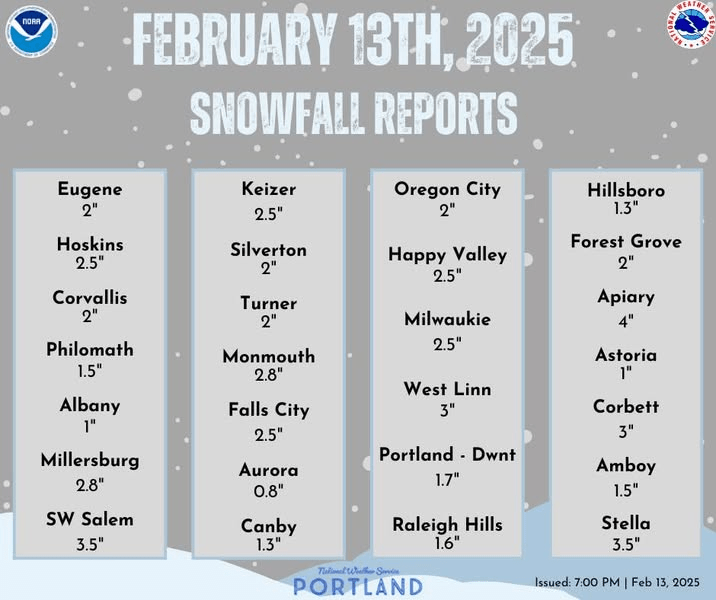
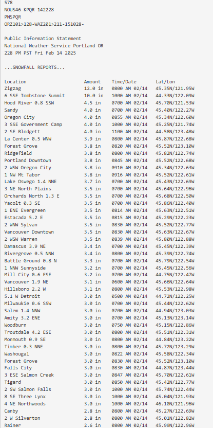
The major widespread impact from this event was the combination of snow, sleet, and freezing rain. By the morning of Friday, February 14, 2025, most areas had received between 3 to 4 inches of snow and ice accumulation.
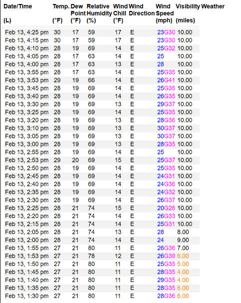
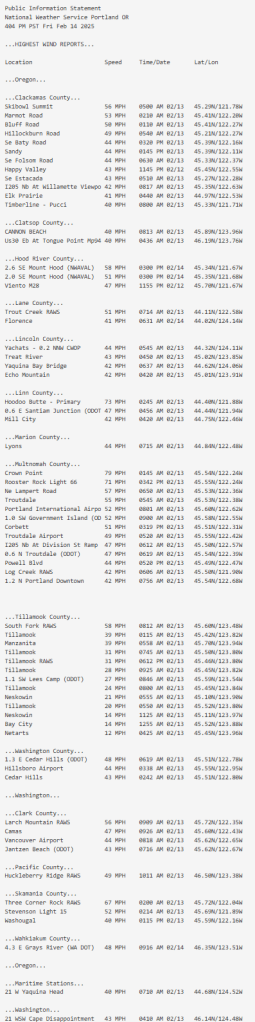
Wind:
Another notable impact from this event was the wind. Easterlies originating from the gorge resulted in significant gusts, particularly on the east side of Portland. Additionally, the modified Arctic air was very dry, contributing to higher accumulation on the west side of Portland compared to the east side.

Leave a comment